
Take A Hike: Rifle Arch Trail
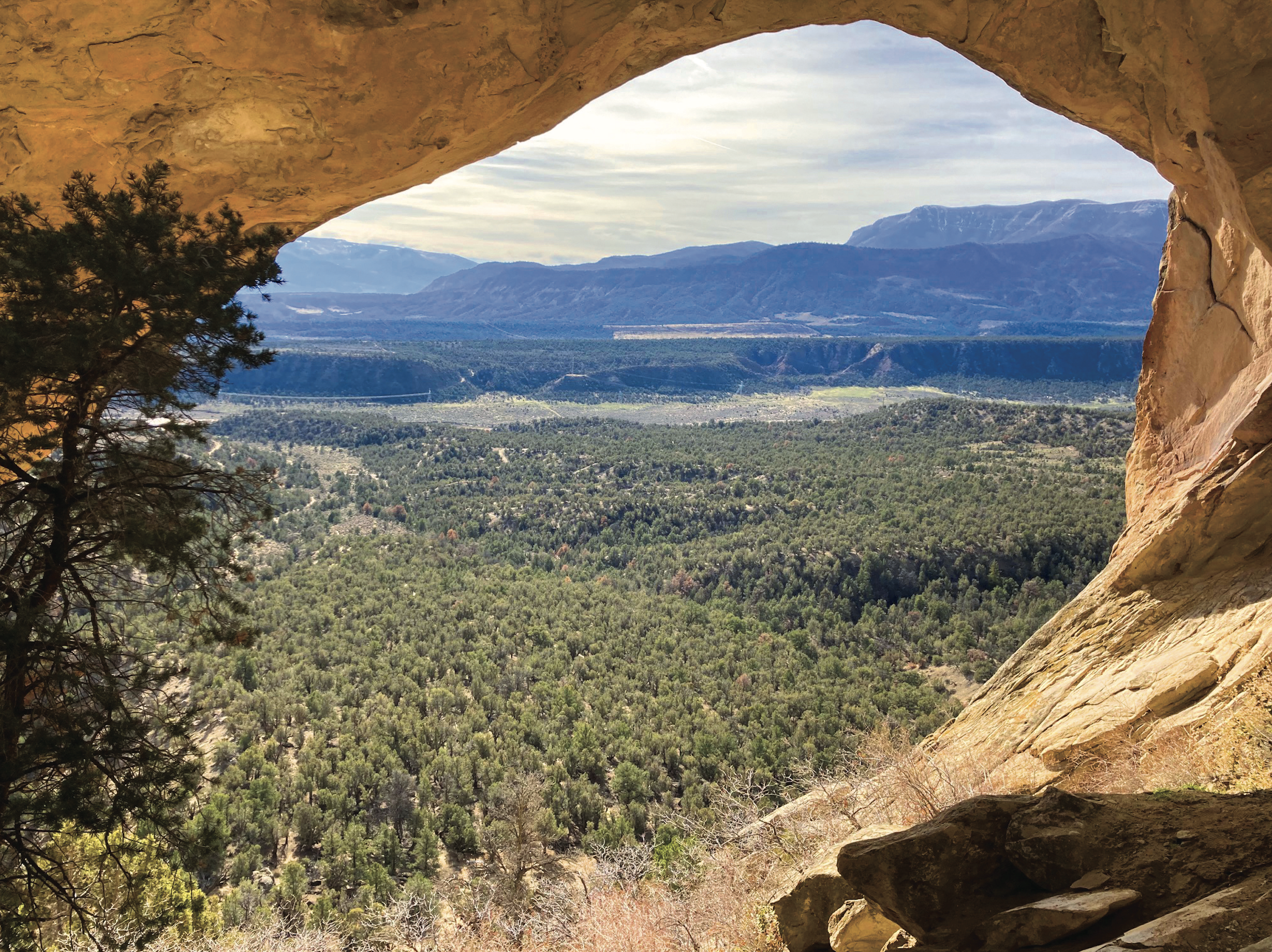
Photo by Melanie Wiseman.
Rifle Arch Trail is a little-known hidden gem — easily accessible, family friendly and dog friendly. At just 1.5 miles each direction to the unique arch destination, this moderate trail is great for hikers of all ages and abilities.
Although a great year-round hike, late spring is the perfect time to enjoy the freshness of new green grasses and cactus blooms. Rifle Arch Trail varies between double and single track, traversing a wash, open sage brush meadows and denser, shady areas of aromatic juniper and pinion. Between flats and gentle uphill slopes, the elevation gain is just under 900 feet. Allow two to three hours round trip.
Be sure to take time for breaks along the way to turn around and look back on where you came from to be rewarded with stunning views. The ultimate reward at the end, however, is the unexpected Rifle Arch itself.
As a first-time hiker to the arch, I wasn't sure of its location. From a distance, the trail leads to a massive, lengthy, craggy, sandstone wall of cliffs where I expected to see the faces of Mt. Rushmore rather than an arch. I continued to be baffled but kept my eye on an unusual comma or crescent shape shadow half way up the massive wall. Ultimately, the shadow was the creation of this unusual arch.
A bench sits at the base of the wall where you can rest and look uphill to the arch. Because of its unique location, the arch can still be difficult to see at this point. If you’re up for the challenge, the last tenth of a mile is a rocky scramble up a fairly random, steep trail. As you climb, the arch becomes more prominent.
Once you reach the arch, take time to enjoy the slickrock amphitheater behind it and the breathtaking, arch-framed views of the Colorado River Valley and mesas beyond. Change locations and angels while within the arch and look skyward to enjoy the great variety of artistic rock formations the arch can reveal.
If you take the hike in the summer months, it can be extremely hot, so hikers should carry plenty of water. Appropriate footwear is also a must as the trail, especially the last climb to the arch, because it is very rocky.
A bonus for those living in the Grand Junction to Eagle area is the ease it can be done: a half-day, spur of the moment outing. The land is managed by the Bureau of Land Management and there are no fees.
With the addition of many new mountain biking trails from the same starting point, the parking area has been enlarged and a restroom added to the dual-purpose trailhead. There is an excellent trail map at the trailhead illustrating hiking verses biking trails. There are a few occasions where the bike trail crosses the hiking trail, but the same trail is never shared.
Having both types of trails from the same trailhead really serves as an advantage for a family or group with mixed interests. Just remember to close the gate between the parking lot and trailhead behind you!
Getting there:
From Grand Junction, take the West Rifle exit #87, to bypass downtown Rifle. After 2.7 miles turn left (North) on Hwy 13 toward Meeker. Stay on Hwy 13 where you will see a prominent parking lot on the right (East) side of the road at mile marker 7.
Originally published in the Spring 2022 of Spoke+Blossom.