
Lower Monument Canyon Trail: Heartbeat Of The Colorado National Monument
“I came here last year and found these canyons, and they feel like the heart of the world to me. I’m going to stay and build trails and promote this place, because it should be a national park.”
— John Otto, 1907, explorer and founder of what would become Colorado National Monument in 1911
Photos by Melanie Wiseman
Although John Otto was a bit eccentric, he can be credited with having the foresight to protect the beautiful area we know and love — Colorado National Monument (CNM). Other than driving the scenic 23-mile-long Rim Rock Drive, hiking the Lower Monument Canyon Trail is probably the best way to see the CNM.
Independence Monument is the most iconic feature of not only Lower Monument Canyon Trail, but of the whole park. Following in Otto’s footsteps in the early 1900s, climbers plant a United States flag at its summit every July 4. This historical tradition has only been cancelled once, the summer of 2025, to protect a nest of vulnerable peregrine falcon chicks.
Lower Monument Canyon Trail is also known for frequent viewings of desert bighorn sheep. Standing in a single spot on the trail, I was fortunate one spring to see 30 adult sheep alongside 10 frisky lambs. Other wildlife in the area includes mule deer, coyotes, mountain lions, collared lizards, red-tailed hawks, golden eagles, turkey vultures, ravens, canyon wrens and pinyon jays.
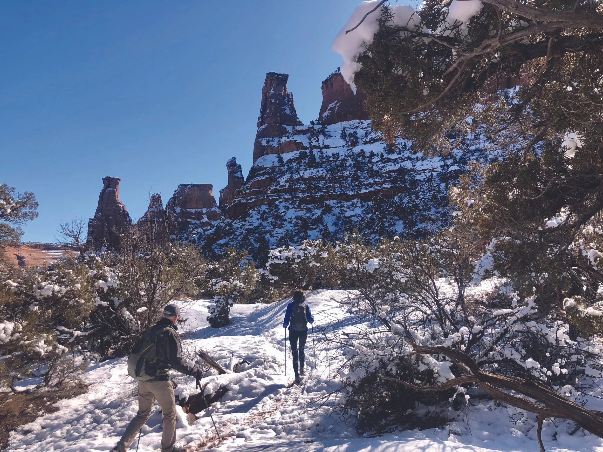
Winter offers a unique and truly magical experience on Lower Monument Canyon Trail. Snow showers paint the desert canyons, creating brilliant color contrasts that can’t be seen any other time of year. Another winter bonus is the good chance of having the trail to yourself. To prevent slick footing, hike in the morning before the sun warms the hard ground.
Getting There
Near mile marker #5 on Highway 340 at the base of the Colorado National Monument, turn west onto a dirt road that appears to be a driveway. The parking area/trailhead is directly ahead after a short downward hill. Portable toilets are available.
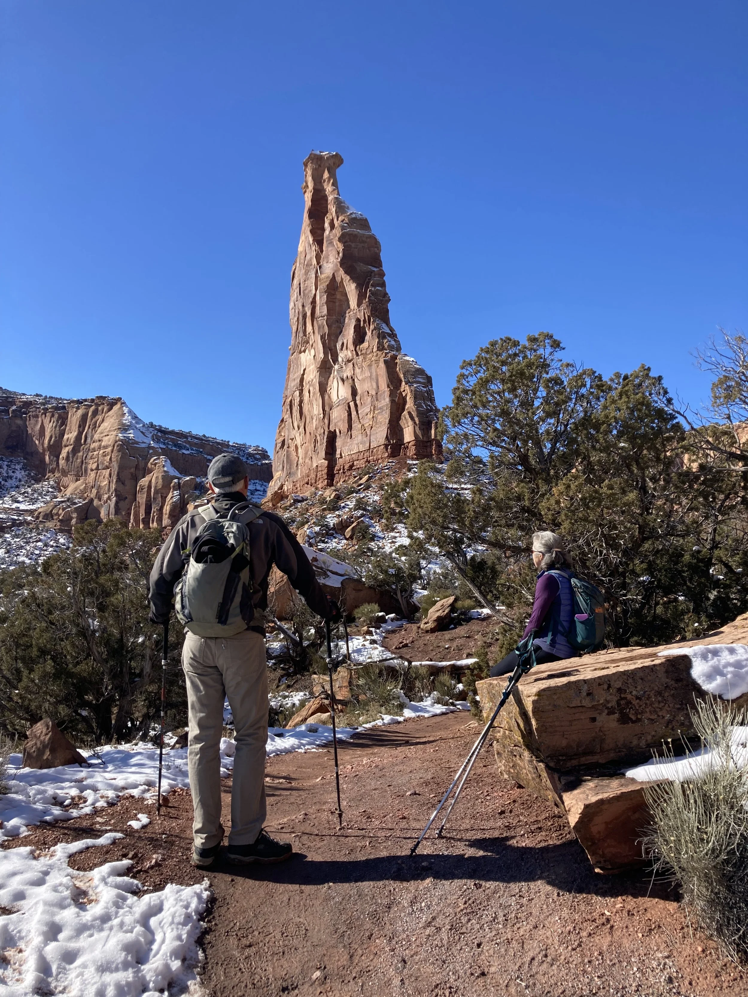
Independence Monument is the most iconic feature of not only Lower Monument Canyon Trail, but of the whole park.
The Trail
Lower Monument Trail begins inside the CNM boundary, so an Interagency Annual Pass or seven-day individual walk-in pass is required. There is a QR code to pay at the trailhead. If you already have an Interagency Annual Pass, you do not need to pay the walk-in fee.
This 5-mile out-and-back trail is considered moderately difficult, gains 600 feet in elevation and takes an average of two-and-a-half hours. This is a family friendly hike; however, dogs are not allowed.
The first 3/4 mile follows the Monument’s boundary before reaching the mouth of the canyon where you get your first view of Independence Monument. The trail is well constructed, easy to follow and alternates between packed sand/dirt, slickrock and a few non-technical scrambles. As the trail gets full sun in most places, winter is a great time to see bighorn sheep basking on the sunny slopes.
Along the trail are gorgeous views of cliffs and various rock and monolith formations including The Kissing Couple, The Pipe Organ, Praying Hands and Sentinel Spire. Most people turn around after reaching 450-foot high Independence Monument — the highest free standing rock formation in the park.
Other tempting options include tracing the primitive, rough circumference of Independence Monument’s base, turning right to descend the shady, unimproved Wedding Canyon Trail for a loop or continuing left another 3.5 miles for a one-way through hike to Rim Rock Drive, which requires a shuttle.
Places to stop and rest along the way are plentiful. Be sure to pause frequently and take in the “Monumental” views.
Originally published in the winter 2025-26 issue of Spoke+Blossom.