
Take A Hike: Phipps Arch
In a remote part of southern Utah, the once lesser visited Escalante area is now a popular destination for adventure seekers. Spring and fall months find Lower Calf Creek Falls and hikes off Hole-in-the-Rock Road buzzing with activity. For an experience full of variety, awe and solitude, venture into the nearby hidden gem hike to Phipps Arch. A fun short spur to Maverick Natural Bridge is an extra bonus.
The trail is located within Grand Staircase-Escalante National Monument, above Phipps Wash, a tributary of the Escalante River and roughly halfway between the towns of Escalante and Boulder, Utah.
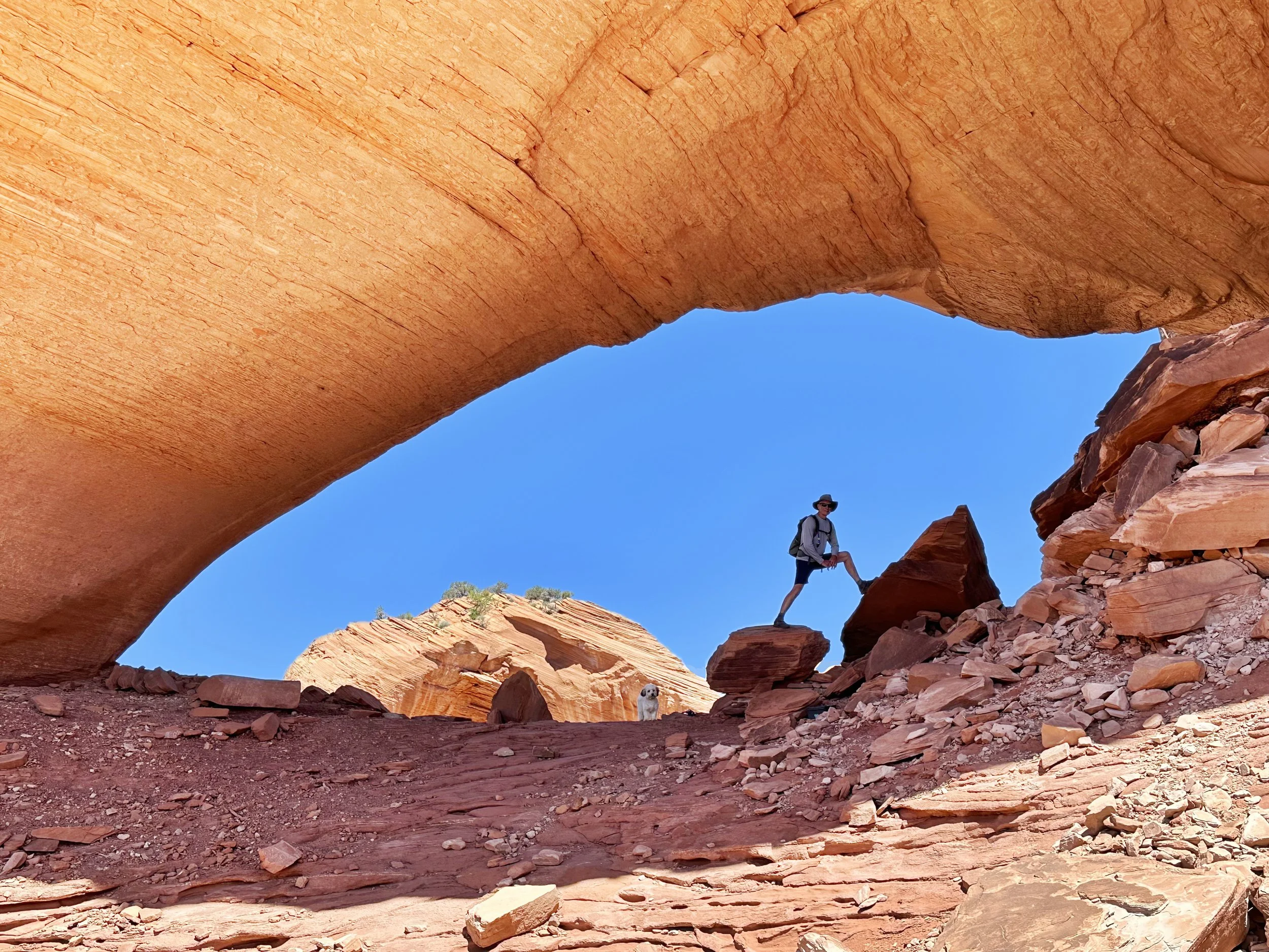
Phipps Arch adjectives include “robust,” “beefy,” “chunky” and “massive.” Penetrating a Navajo Sandstone dome, it spans approximately 100 by 30 feet high. The shaded interior provides a welcome refuge from the sun and comfortable location to enjoy inspiring birds-eye views. A photographer’s dream, explore the surrounding swirling red and white Navajo slickrock at leisure. Hiking this trail in late spring gifted us with stunning, showy displays of brilliant prickly pear cactus blooms.
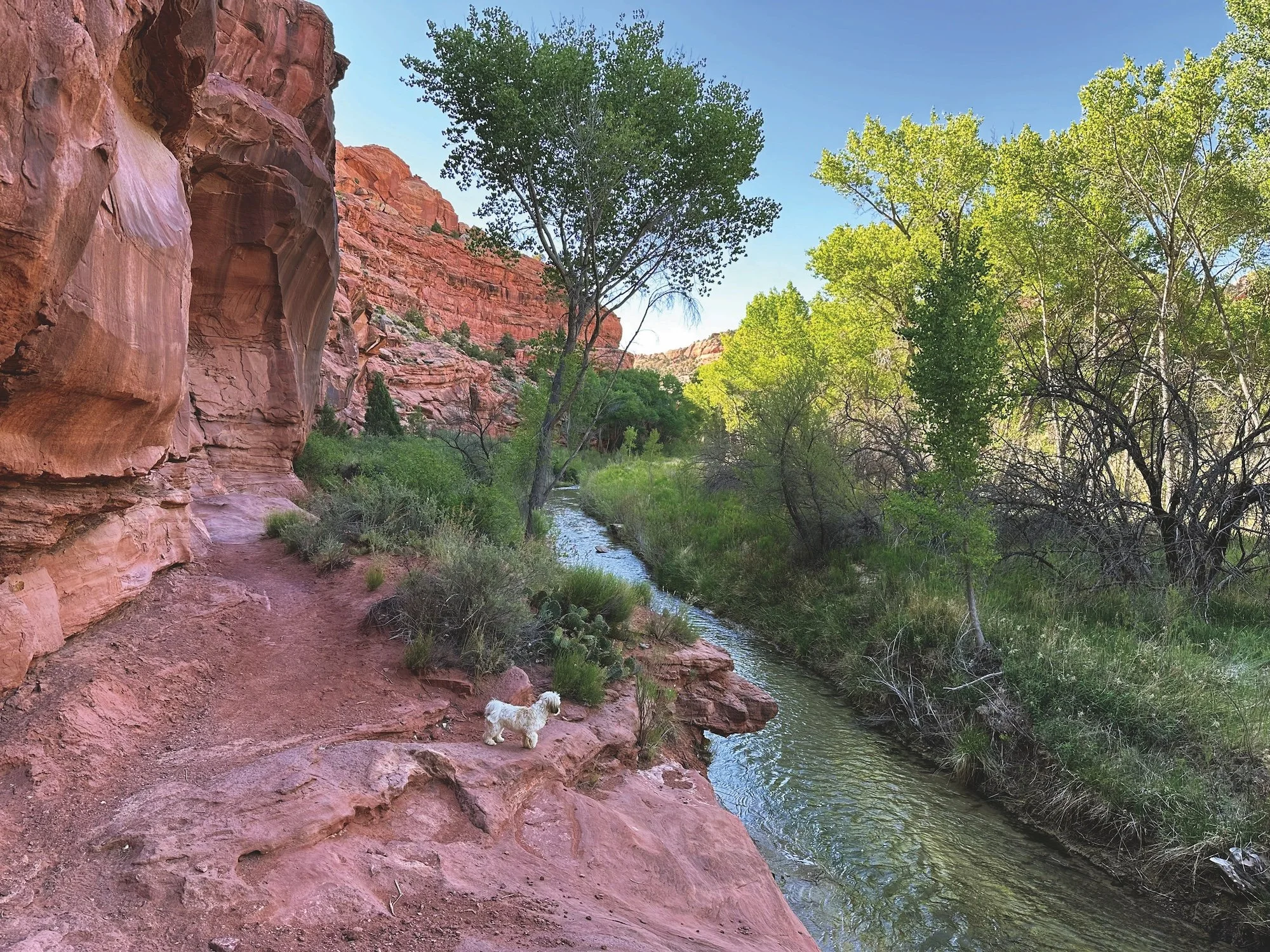
Plan on getting your feet wet at three Escalante River crossings, which can range from ankle-deep to 18 inches depending on the season and runoff levels. Or, if tempted like we were, enjoy a refreshing plunge.
Photos by Melanie Wiseman
THE TRAIL
Allow four to six hours for this 6.5-mile out-and-back day hike with a full spectrum of Escalante ecosystems, from the dry mesa top to the riparian canyon and Escalante River. Phipps Arch Trail is an unmarked, unmaintained — yet well recognizable — path requiring a decent map and route-finding skills. The trail is considered moderate except for the steep scramble up to Phipps Arch itself.
After crossing beneath the Highway 12 bridge, the trail follows a bench on the left side of the river, through shady cottonwoods and willows. The first river crossing and major bend in the river comes at 0.8 miles. Opposite the ford, the trail continues on a bench which soon gives way to Kayenta slickrock reaching into the river. Here you’ll wade shallow water at the river’s edge for about 30 yards.
At 1.5 miles, Phipps Wash enters from the right. The route crosses the river once more en route to sandy Phipps Canyon, where you leave the Escalante River. Phipps Arch is about a mile up Phipps Wash; however, after roughly half a mile, a sandstone tower marks a side canyon and short spur to Maverick Natural Bridge — a thin, 20-foot sliver of slickrock tucked into an alcove and well worth the detour.
After returning to Phipps Canyon, continue another 0.5 mile or so to a large side canyon veering left. The trail going up to Phipps Arch begins immediately. As we found out, going up the side canyon much at all means you’ve gone too far. Simply put, when the worn path disappears, it’s time to look for the numerous cairns marking the steep climb up slickrock slopes and ledges. From the wash to the arch, the trail gains about 335 feet in just over 0.3 mile. You are soon rewarded with your first panorama of Phipps Arch, totally worth the effort.
GETTING THERE
Parking is 14.6 miles south of Boulder, Utah and 13.3 east of Escalante, Utah on Highway 12. The prominently signed Escalante River Trailhead parking is located immediately north of the Escalante River Bridge (there is also parking along the road on the south side of the bridge). This parking is also for Phipps Arch Trail.
Originally published in the spring 2026 issue of Spoke+Blossom.